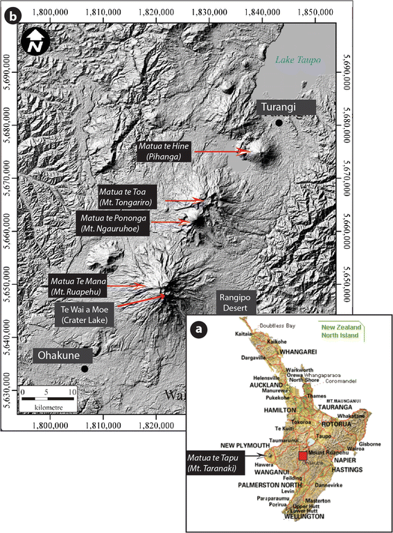
Figure 1

Location map of Mt. Ruapehu at the southernmost end of the Taupo Volcanic Zone (TVZ) in the North Island of New Zealand (Te Ika ā Māui). The general view of the North Island (a) is based on the map provided by http://prosale.co.nz/html/map.html, where the location of Mt. Taranaki can be seen, offset from the Tongariro Volcanic Centre (green square); the latter, comprising Mt. Ruapehu, Mt. Tongariro, and Pihanga volcanoes is shown in (b), based on a STER GDEM, 30 m resolution DEM. The coordinates are UTM.